
Haebangchon to Itaewon: A Less-Tiring Downhill Route
Ride Yongsan02 high into Haebangchon, then descend through Gyeongnidan to Itaewon with live-transit checks, energy options and honest accessibility limits.
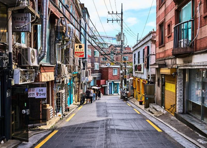
The tiring way to combine Haebangchon, Gyeongnidan-gil and Itaewon is to leave the subway and climb toward Namsan. The smarter order is bus up, then work mostly downhill: use Yongsan02 to reach Haebangchon Ogeori, begin near Sinheung Market, descend through Gyeongnidan and finish at Itaewon Station.
This is a net-downhill route, not a flat or step-free route. Haebangchon still has steep grades, short rises, stairs, broken pavement and narrow roads. The bus removes the longest sustained ascent; it does not remove the hillside.
Route in one minute
- Leave Noksapyeong Station Exit 2.
- Walk about five minutes to the Hanshin Apt. village-bus stop, following the historical Visit Seoul access directions.
- Take Yongsan02 to Haebangchon Ogeori (해방촌오거리).
- Walk the short final stretch to Haebangchon Sinheung Market.
- Descend toward Gyeongnidan-gil, keeping optional side alleys short.
- Continue to Itaewon-ro and finish at Itaewon Station.
The municipal Seoul Love neighborhood feature also identifies Yongsan02 as the useful local link among Namyeong, Sookmyung Women's University, Noksapyeong and Haebangchon's hills. Both pages are route context, not a live timetable. Confirm today's boarding point, direction and arrival display in a Korean transit app.
- 1Haebangchon Sinheung Market
- 2Gyeongnidan-gil
- 3Itaewon Station
The embedded map covers the walking handoff from the market to Gyeongnidan and Itaewon; it does not include the initial subway-to-bus walk or bus ride. Google pedestrian data can be incomplete on small Korean lanes. Save the same stops in Naver Map and check the live path, closures and elevation before each long descent.
Why start high
The official Visit Seoul alley description places Haebangchon on a Namsan slope and notes the upper area is harder to reach. A recent KoreaTravel discussion says more bluntly that the incline is challenging and recommends taking a bus upward. That comment is lived experience only; official pages establish the geography and transport.
Starting at Itaewon reverses the advantage: you climb through Gyeongnidan and Haebangchon before reaching upper views. Starting near Sinheung Market spends less energy on access and leaves more choice for exploration.
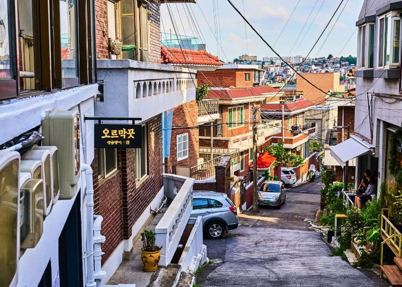
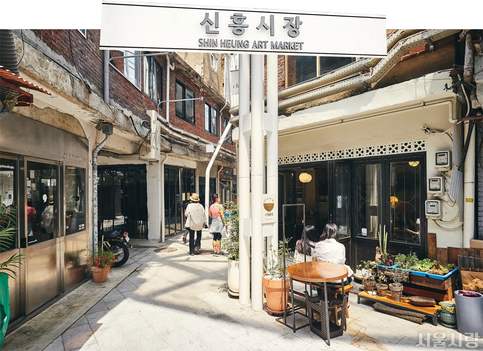
The lane and gateway illustrate the strategy. They do not prove every junction is downhill or accessible.
Step 1: take Yongsan02 in the correct direction
From Noksapyeong Exit 2, follow the saved route to Hanshin Apt. and verify 용산02 on the vehicle and live display. Village buses are smaller than Seoul's main buses. Use a valid transit card and tap on and off according to the current system.
Show 해방촌오거리 to the driver if uncertain, but do not depend on a driver being able to provide English navigation. The current Seoul Future Heritage listing names Haebangchon Ogeori stops 03-588 and 03-517 with Yongsan02; the two stop IDs represent opposite sides/directions, so match the live app rather than selecting one from the article.

This is not door-to-door. The Seoul Metropolitan Government's market page historically describes about 70 m from Haebangchon Ogeori, but entrances, crossings and temporary works can change. Expect a short final walk with possible incline.
Step 2: use Sinheung Market as the high anchor
The current Visit Seoul page, edited May 4, 2026, lists 95-9 Sinheung-ro and says hours vary by store. The market is the anchor; a specific café or restaurant is optional. Check each business's latest notice rather than copying hours from an older neighborhood feature.
Pause here and choose an energy plan:
- Short, about 2.5–3.5 hours: one market stop, direct practical descent, Gyeongnidan as a pass-through, finish at the station.
- Balanced, about 4–5 hours: one upper detour, one Gyeongnidan meal or café, then Itaewon dinner/exit.
- View-focused: add the Sowol-ro deck mentioned by Seoul Love, described as about five minutes along the upper road. This is an out-and-back with extra grade, not part of the low-effort core.
These are editorial planning ranges, not measured travel times. Queues, wrong turns, weather and business stops can extend them.
Step 3: descend deliberately
From the market, work south and southeast. At every junction:
- Prefer a broad road that visibly continues downhill over an unseen stair exit.
- Recheck before committing to a long descent; correcting a wrong downhill turn means climbing back.
- Skip a photogenic lane that drops sharply then appears to rise.
- In rain, ice, extreme heat or poor light, favor wider paved streets and shorten the route.
- Do not walk in the vehicle path on a blind bend; local roads can be narrow and shared.
“Mostly downhill” describes the overall direction. Short climbs remain, and downhill can stress knees more than expected. Shoes with grip and a light bag matter.
Step 4: make Gyeongnidan the decision point
Gyeongnidan-gil is a neighborhood spread, not one attraction with shared hours. Reach the marker, then pick one meal, café or browse rather than zigzagging through every parallel alley.
This is where a group can split. Tired travelers continue to Itaewon Station; others add a small loop and reunite on the flatter Itaewon-ro corridor. Keep your saved places organized with the Naver Map saved-places guide, but let live routing override a saved path.
Step 5: finish at Itaewon Station
Aim for the station, not a vague “Itaewon” pin. The main road offers subway access, taxis, convenience stores and more dining choices. For an afternoon-to-evening version, read upper slopes in daylight, use Gyeongnidan for food, then finish after dark near transit. Check the last service in your transit app on the day; this article deliberately gives no fixed final-train time.
Accessibility and bad-weather exit
This is not a wheelchair-accessible or guaranteed step-free itinerary. It is unsuitable for heavy rolling luggage and can be difficult with strollers or painful knees. The Visit Seoul 108 Steps feature describes an inclined elevator west of the main route, but one facility does not make the wider neighborhood accessible; it is also a detour and may be unavailable.
If mobility is limited, use Yongsan02 or a taxi point-to-point and choose one upper stop. In rain, snow, ice, high heat or after dark, reduce alleys and use transit for the remaining leg. Never treat “downhill” as automatically safe.
If you are traveling with suitcases, arrange a nearby Delivery Spot before this outing. Narrow slopes, stairs and small venues are a poor luggage-storage plan.
Day-of checklist
- Save 해방촌오거리, 신흥시장, 경리단길 and 이태원역 in a Korean map app.
- Verify the live Yongsan02 direction and current Hanshin Apt. boarding point.
- Check each must-visit business separately; market hours vary by store.
- Check rain, ice, heat and daylight; wear shoes with grip and carry water.
- Keep the bag light and download key pins if connectivity is unreliable.
- If the bus wait is long, compare a taxi or another bus connection instead of automatically walking uphill.
The current official pages reinforce the core facts: Visit Seoul's market listing gives the address and variable hours; the Seoul city market page connects Yongsan02, Haebangchon Ogeori and the market; Seoul Future Heritage lists the stop IDs and route; and the Visit Seoul page edited June 17, 2026 still describes steep stairs and hills.
Information rechecked August 12, 2026. Official place pages establish geography and access context; live transit, navigation, weather and on-site controls take priority.
Sources and asset credits
- Featured asset — Seoul Tourism Organization / Visit Seoul editorial image; locked featured asset retained.
- Body asset 1 — Seoul Tourism Organization / Visit Seoul editorial image; locked order retained.
- Body asset 2 — Seoul Tourism Organization / Visit Seoul editorial image; locked order retained.
- Body asset 3 — Seoul Metropolitan Government / Seoul Love editorial image; locked order retained.
- Official source — Visit Seoul, historical Noksapyeong Exit 2–Hanshin Apt.–Yongsan02 access directions.
- Official source — Seoul Love, municipal neighborhood feature covering slope, market, viewpoint, Yongsan02 and 108 Steps elevator.
- Official source — Visit Seoul, Haebangchon slope and upper-area context.
- Official source — Visit Seoul, Haebangchon/108 Steps alley context; retained published source.
- Official source — Visit Seoul, Shinheung Market page edited May 4, 2026; address and store-specific hours.
- Official source — Seoul Metropolitan Government, market address and historical Yongsan02–Haebangchon Ogeori access.
- Official source — Seoul Future Heritage, current Haebangchon Ogeori stop IDs and Yongsan02 listing.
- Official source — Visit Seoul page edited June 17, 2026; steep stairs and hills.
- Google Maps route handoff — Exact three-marker route URL retained from the published guide.
- Naver Map market search — Exact Korean map URL retained from the published guide.
- Community context only — Hill difficulty anecdote, not transit or accessibility evidence.
Last updated


